Author: Ludo Joosen

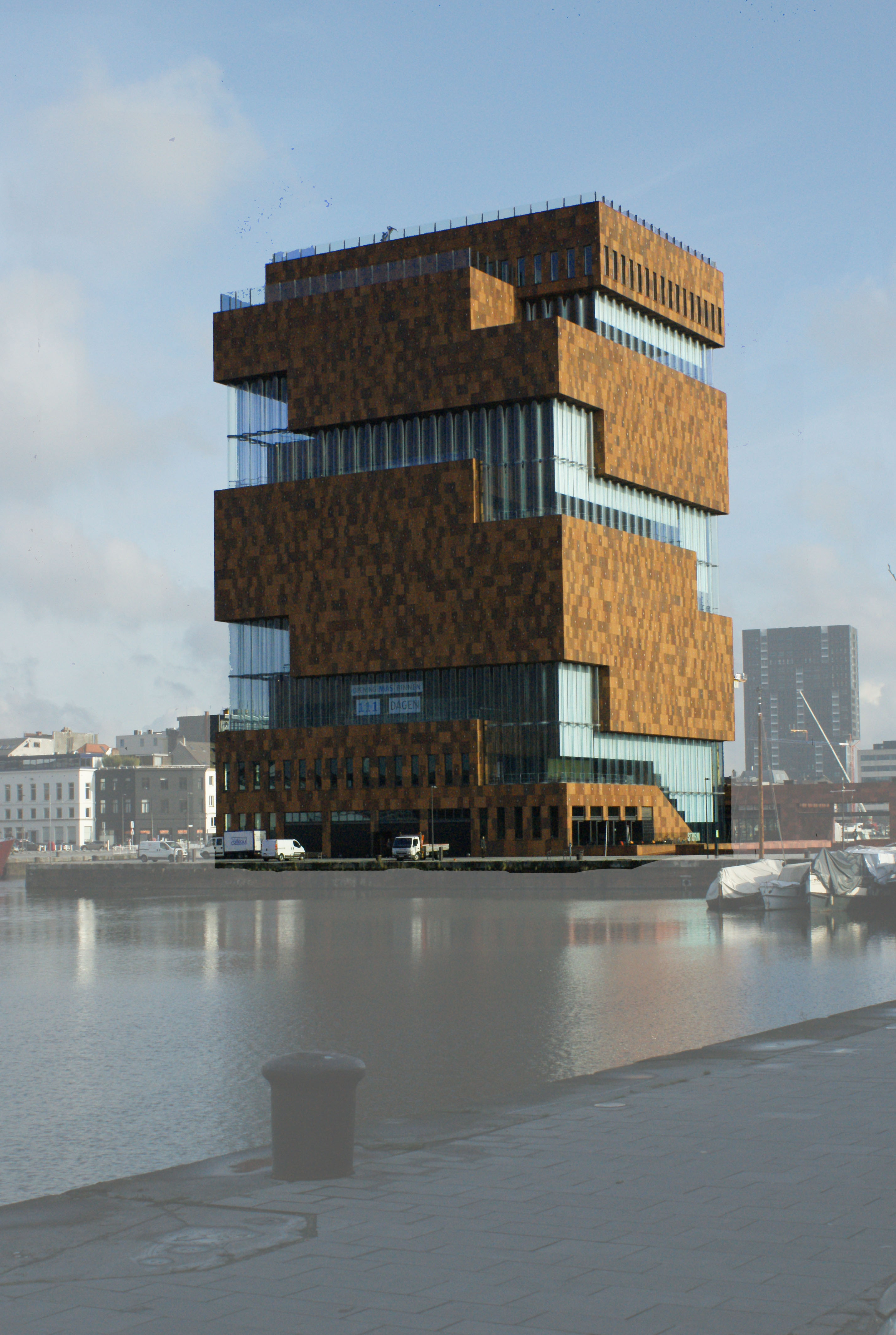
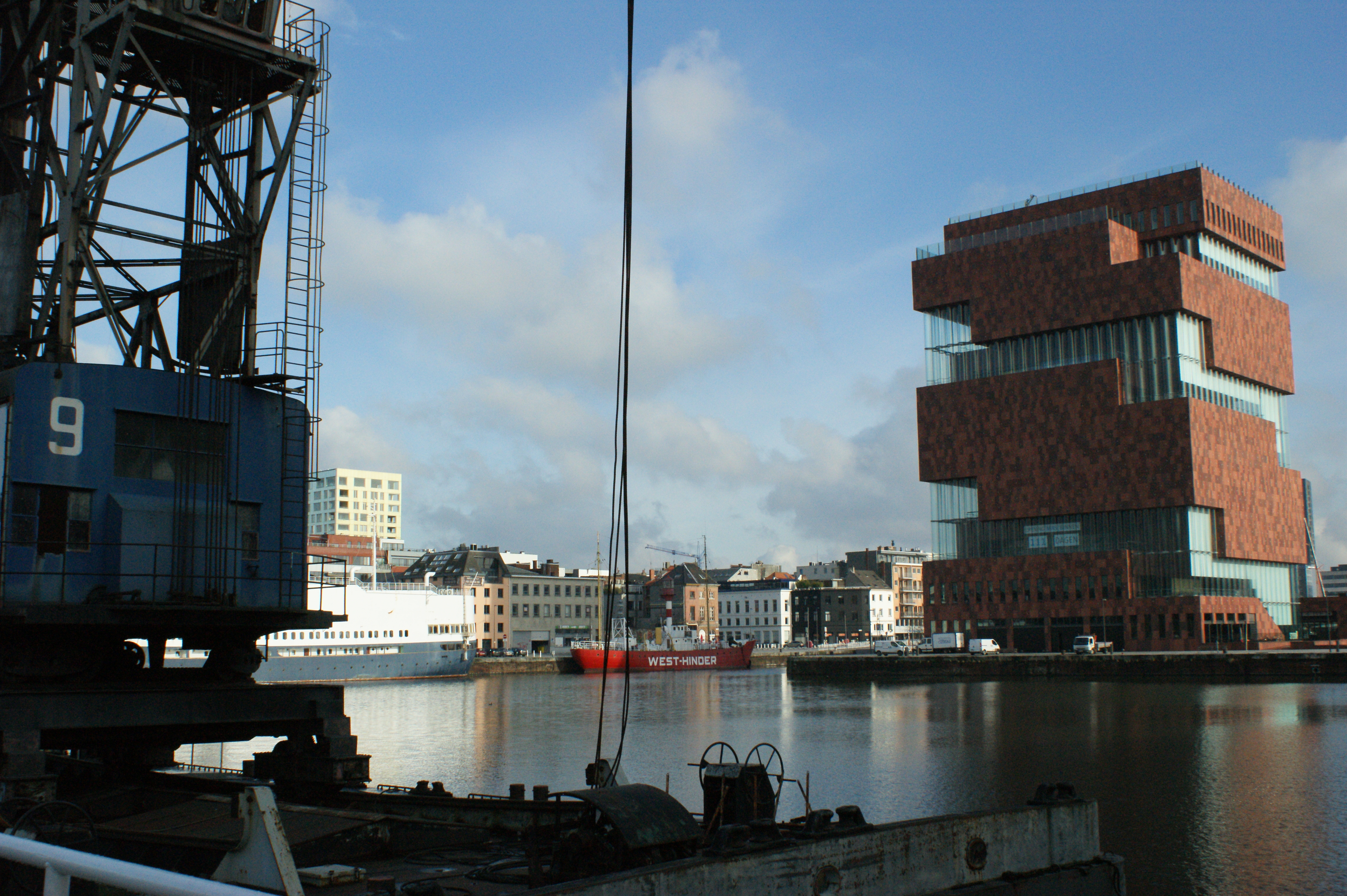
World centre of diamond trade

Almost any diamond, at one time or another in its lifetime, passes through the Antwerp diamond quarter. In the nineteenth century it were jewish people who traded in diamonds. They used to travel by train from Antwerp to Amsterdam and back. So it is only natural that you can find the diamond quarter right next to Central Station.

Part of the diamond quarter is sealed off for traffic, but as a pedestrian you can freely walk there. Take notice: Big Brother is watching you while walking in the district. The number of cctv camera’s in the area is really extraordinarily high.

Jeweller’s shops are open to the public of course, but the diamond markets are only accessible to professionals or as part of a guided tour. Practically all of the buildings in Hoveniersstraat, Rijfstraat and so on date from the period after WW II. All of them aim at efficiency and security.

The Portuguese Synagogue

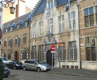
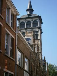
The only artistically interesting building you will see in the area is the sephardic synagogue. The synagogue, locals call it the Portuguese synagogue, was built in 1913, destroyed in WW II, rebuilt, fell victim to a terroristic attack in the early eighties and was rebuilt again.

The name Portuguese synagogue derives from the fact that the Sephardic Jews originatied in Spain and Portugal. The ‘Catholic’ kings of Spain drove them out and eventually they landed in Antwerp. When Antwerp fell under the reign of the very catholic Filip II again, many of them fled to Amsterdam.

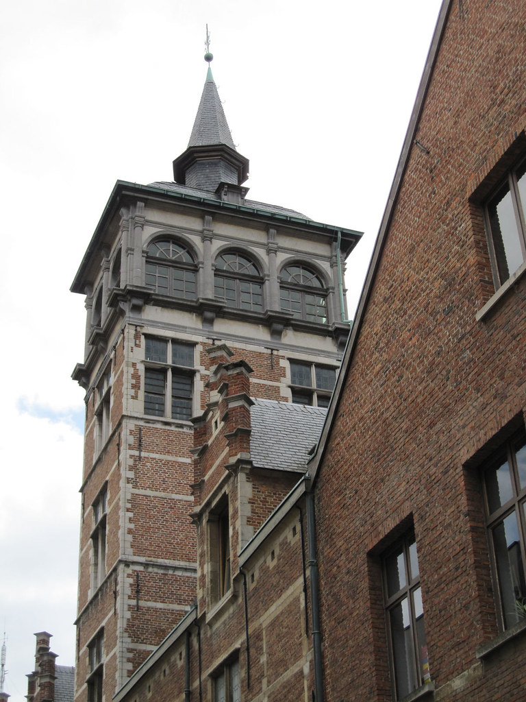
The synagogue is a nice example of neo-romanesque architecture. It might stand a little forlorn between all this modern architectural brutality, but that only adds to its charm.

MAS: a Museum at the Stream

The Mas Building

In between the two oldest docks of the Antwerp harbour a remarkable building stands, built in a striking red colour: the MAS. Collections of more than three separate musea have been gathered here to tell the story of our town and its harbour.

Each floor of the museum tells a part of this fascinating story. The 2nd floor allows you to have a peek at how a museum works. Here you can see part of the depot: the objects that are not (yet) on display, but form a reserve. Floor 3 has temporary exhibitions.

The permanent exhibition

Floors 4 to 8 have more or less permanent exhibitions. At least: the aspect they try to tell remains the same. Floor 4 is about wealth, power, prestige and its symbols. The next floor is called ‘Antwerp à la Carte’ and shows you how towns are responsible for feeding huge masses of people. Follows a floor devoted to the harbour. Floor 7 is about death and the afterlife and how the different religions that are present in the city deal with these questions. Floor 8 has a very rich collection of pre-Columbian art from South-America.

Another view of the MAS

On floor 9 you can enjoy a delicious meal in “‘t Zilte” a two-star restaurant lead by Vikki Geunes. From floor 10 you have a fantastic view over the city and its harbour.

Floors 2 and 10 can be visited for free, for the other floors there is an entrance fee.

The different floors 4 to 8 all have the same lay-out which starts with a short introduction to the theme in question. Then you enter the exhibition space as such. After that there is a section where you can find some more information, where kids can enjoy an interactive game, …

Another attraction is the hallways. As you travel from floor 1 to floor 10 you will pass a series of photographs that again tell a story about town. At this moment the theme is ‘Koekenstad’ (Cookietown). This was the nickname people from the country gave to Antwerp. Antwerp had many industrial bakeries, candy and chocolate factories. About twice a year the theme of these photographs changes.

Want to know more? http://www.mas.be/en

Rockoxhuis: another example of wealth from the Golden Age

2 Comments
View of the Rockoxhuis
Portrait of Nicholas Rockox

The mansion that was once occupied by mayor Nicholaas Rockox now houses a museum.

In the early 17th century Nicholaas Rockox bought two houses in the Keizerstraat and had them rebuilt into one large mansion with an inner court. Over the years the building changed appearance. It’s got a completely new facade early 18th century as one can still see in an inscription on top today: 1702.

Late 19th century  it was turned into an antique shop and each and every room was changed into the style of a particular period. Later on an artistic circle used the place for its activities, but these never really got off the ground. Except for one: the cellar that was used as a dancing. As the University was only a stone’s throw away, many student organisations used the cellar for their parties. But the overall building started to deteriorate and eventually Kredietbank, a financial institution bought the place with a dual purpose.

A Bank comes to the rescue

Kredietbank wanted to create a museum that restored the house to what it might have been like in Rockox’ time. Rockox was a fervent collector of art. Rubens was a personal friend of his, so in his collection featured a number of works of Rubens and his contemporaries. But also older artists were represented in the collection. This collection is now spread all over the world, so a new collection now adorns the walls of the museum.

View of the Rockoxhuis

Kredietbank also needed a place in Antwerp where it could receive guests and organise trainings for its personnel. So they not only bought Rockox’ house, but also the house of painter Snijders next to it.

The museum has a permanent collection, but while the museum of fine arts is still being restaurated, it also organises temporary exhibitions in which it uses works that belong to the collection of this museum of fine arts. Until July 2 an exhibition shows a nice set of landscapes from the Low Countries. The landscape as an art form really got shape in the 16th and 17th centuries, here in the Low Countries. The paintings in the exhibition come from the museum of fine arts, but also from the Staatliche Kunstsammlungen Dresden.

More on the museum: https://www.rockoxhuis.be/en/

More on the exhibiton: https://www.rockoxhuis.be/en/exhibitions/now

Van Straelentower: the higher the richer

The Van Straelen Tower
Van Straelen’s Tower (Source: erf-goed.be)

In the neighbourhood of Hof van Liere and Saint-James’ Church (St-Jacob) you can find a very nice example of a ‘pagadder’ tower. The tower belonged to the mansion of mayor Gilbert Van Straelen. He lived in the 16th century. You can find the tower in the Korte St-Annastraat at the end of the Frans Halsplein.

The word pagadder is a bastardization of the Spanish pagador or paymaster. In the local dialect pagadder for some reason has become the name for a small boy. Maybe it is because the Spanish paymasters (soldiers whose responsibility it was to pay the other soldiers’ wages) were much smaller and weaker than their active colleagues.

It is said these young boys had to sit in the tower and look out for ships sailing into the harbour. As soon as they saw a ship, they had to inform their master of the arrival.

That should explain the existence of the towers. It may be clear from this example that this old story is just a tale. From here it is impossible to see the tiniest part of the river.

Italian influence

These city towers arose in the sixteenth century. They are based on Italian examples. It is no wonder that they appeared in this timeframe. Many artists from the North went to Italy to learn about renaissance art. They did not only bring along sketches of ancient sculptures and modern paintings. They also drew the places they had visited.

Van Straelen Tower seen from the inside
Seen from the inside (Source: inventaris.onroerenderfgoed.be)

Very soon the major families and merchants started to outdo their competitors by building city towers that were higher and more impressive than their competitors’. Van Straelen’s must have been one of the best examples. We will never be really sure because at one time there must have been over 40 of these constructions. Only a handful have survived.

But they were functional nonetheless

Smart merchants do not only think of prestige, at least not all of the time. These towers are a nice example hereof. Inside the towers a staircase between the different storeys of the house could be built. That way more space remained available inside the rooms. Most towers are tucked away in a corner and are much smaller than Van Straelen’s.

The building is now used by Emmaus, an organization that takes care of young people who live in difficult circumstances.

Quite an introduction!

If you want to have a really nice idea of some of the nice things the city of Antwerp has in store for you, visit https://app.nimia.com/video/6528/i-love-antwerp-antwarpe-39kzien-a-zoe-geire-tjoez-, enjoy the video and then get ready to enjoy the real thing.

Some of the things you’ll see: Central Station, Groenplaats, Cathedral, skyline, pedestrian tunnel, … All pictures were taken a few years ago (2012) and you’ll get a chance to hear the local dialect as sung by a band called the Strangers.

Meir: a swamp turned into a shopping center

Meir Shopping Street
Source: Alles over Antwerpen

Today the Meir is the shopping heart of Antwerp, visited by millions of people each year. Around 300.000 people a week visit the Meir, so be sure you’ll never feel alone. Most of the buildings you see there date from the 20th century. Two notable exceptions you will find in the middle part. Both are works of Jan-Pieter van Baurscheidt, the most important architect of the 18th century. He built the Osterriethhouse (currently under restauration) and the so-called Royal Palace, both for the van Susteren family in the middle of the 18th century.

There are many other remarkable buildings a bit further east. For instance the former Tilquin store (nowadays a Massimo Dutti shop) which is a remarkable example of art deco. This is worth a story of its own. So is the ‘Stadsfeestzaal’ (the City Festive Hall) and the buildings Innovation now occupies, that once belonged to Leonard Tietz.

Meir = Moor

Hand sculpture
Source: meir-antwerpen.be

The name Meir is like the word moor in English: a wetland, and indeed the most western part of Meir lay lower than the surrounding places, so water gathered there. Until the 12th century the city walls were situated just west of the Meir. When the city started growing in the 13th century, the Meir was turned into a canal with walking space on both sides.

Important people started to settle around the Meir. Among them the Pijpelinckxfamily, traders in tapestry. A grandson of theirs would turn out to be a genial painter: P.P. Rubens.

Gradually the waterway was covered and the city grew further east. In the 19th century the council decided to demolish the old defensive wall. At that moment they also decided to create a new axis of avenues to greet arriving visitors. The first part of the axis was the Leysstraat, the second part the Meir. Until the late ’80s of the 20th century the Meir was full of traffic. After the underground tramway was built the council turned it into a pedestrian area. A real success, taking into account the 300.000 visitors that walk the Meir every week.

Hof van Liere: a symbol of wealth

Between 1515 and 1520 Arnold van Liere, mayor of the town, had a mansion built on newly developed grounds to the east of the city. People say one of the many guests to stay with mayor van Liere was the young Charles of Habsburg. The same one who later became Emperor Charles V. That is why this mansion is still called Prinsenhof. It also explains how the Prinsstraat got its name. Another visitor to stay with van Liere was the German painter Albrecht Dürer. In his diary he wrote he had never before seen a house so beautiful, so rich. One of the architects for the complex is Domien De Waghemaekere, one of the top architects of the era.

Different functions for Hof van Liere

Hof Van Liere – First Inner Court

After van Liere’s death the city bought the complex and housed the English Nation in it. A corridor linked the complex with the wool store houses in the Venusstraat. After the Spanish Fury of 1576 many English traders decided to leave the city. By 1583 the English House stood empty.

In 1601 Albrecht and Isabella wanted to install the house as their residence. This was refused by the magistrate. They preferred to hand over the complex to the jesuits. They wanted to use it to house their college that had grown too big at Conscienceplein.

In 1713 the jesuit order was abolished. In the Austrian period the buildings were used as a military academy. The French used it to house a military hospital in it. Afterwards the building started to be neglected and got the nature of a ruin.

Re-enter the jesuits

Library in City Campus UA
Source: Vlaamse Erfgoedbibliotheek

In the first half of the 20th century the jesuits took possession of the neglected buildings. They started a series of restaurations and renovations to make the building fit for their Higher Commercial School “Sint-Ignatius”. In the ’60s this highschool was transformed in a university. UFSIA (Universitaire Faculteiten Sint-Ignatius), which later fused with the other Antwerp university center (RUCA, run by the government) to eventually form the University of Antwerp.

Nowadays Hof van Liere houses the City Campus of UA. In recent years a completely new library has successfully been incorporated the historical buildings.

The website of UA: https://www.uantwerpen.be/en/

Central Station: 19th century splendour

A wooden station as a start…

Traditionally visitors entered Antwerp by boat, but in the second half of the 19th century this suddenly changed. A new way of transportation developed very rapidly: the railways. Belgium was the very first country on the mainland to develop a network of railways. The first track was opened in 1835 and transported passengers and goods from Brussels to Mechelen and back. Only a year later this track extended into Antwerp and a station arose.

A very first wooden building located more or less at the crossing of Carnotstraat and Astridplein, served as a station. In the very first years this area was rather desolate. It lay completely outside of the city borders as the city was still held behind its ‘Spanish’ walls, the present-day ‘Boulevard’ consisting of Italiëlei, Frankrijklei, Britselei and Amerikalei. That also explains why the Zoo is situated in this same area: grounds were cheap.

An old postcard showing Central Station
An old postcard showing Central Station (Source: architectura.be)

From the 1850s on harbour activity in Antwerp started booming again. The town drew thousands of labourers from the neighbouring countryside and new living quarters had to be devoloped.

Among others in the neighbourhood of the railwaytrack. So when, at the end of the 19th century we wanted to build a new station and extend the railwaylines further north, this had become impossible.

for a Railway Cathedral

Inner view of Central Station
Inner view of Central Station (Source: expedia.be)

A new station was built, ordered by King Leopold II who had a flair for developing huge projects. He is the one e.g. who was responsible for the ‘restoration’ of medieval Bruges. The new station had to be a prestigious building to welcome visitors from all over the world.

The architect de la Canserie created a building based on ancient examples like the Pantheon, adding style elements of renaissance, baroque and classicism, using new materials and techniques and in fact creating a showcase of the different kinds of stone that the Belgian soils contained.

In recent surveys the Antwerp Central Station was often listed among the most beautiful railwaystation in the world. So make sure you have a look at it now that it has been restored in its original splendour.

Conscienceplein: start of a new era (2)

The library

Last Thursday I ended by talking about the building on the west side of the Conscienceplein: the sodalities. After the pope had abolished the jesuits in 1773 the buildings and everything in them were publicly sold. The building the sodalities had occupied in the previous years got different functions. It was a workshop, warehouse, dancing hall, public bar (a brewer’s advertisement can still be noticed) and so on. In 1879 the City Council bought the building to house the town’s library.

map Conscienceplein
Map Conscienceplein (source Googlemaps)

In fact there were two: a library of old, valuable books and manuscripts and a library where people could rent the more current type of books. That is why at the end of the 19th century a statue of Hendrik Conscience was placed in the niche of the sodality. Hendrik Conscience at that time was the most important author in Flemish literature, as popular in Flanders as Victor Hugo was in France.

From about 1622 till the French revolutionaries demolished it, a statue of the Holy Virgin has stood in the same niche.

You can find the entrance to the library now in Korte Nieuwstraat. Guided visits are organised and the 19th century ‘Nottebohmzaal’ certainly is worth a visit. These visits start from the green door in the south-west corner of the square. [http://www.consciencebibliotheek.be/en]

The church

The building opposite the sodalities/library is the old jesuits’ church devoted to Saint Carl-Borromeus. It is generally accepted that Rubens had a hand in the decorations of the façade and of the bell-tower which you can find at the back-side along Sint-Kathelijnevest.

It is clear the church is built in the typical jesuitstyle as laid out by the Roman Il Gesù Church. Giving a detailed description here would lead us too far, so have a little patience.

The square

Young people at the iceblock blockades.
Young people at the iceblock blockades. (Source: Mhka).

In the 1960’s this square was the scene of an artistic uprising, joined by many young people in town to put an end to the reign of the Car. Using huge blocks of ice they blocked off the entrance to the square for cars. Musicians, artists, dancers and pedestrians took over the space. The uprising was a success and not only the square, but also the surrounding streets became the very first pedestrian zone in Antwerp. Of course for weddings and funerals car can still enter the square.

Short video fragment (Dutch commentary).

Conscienceplein: start of a new era (1)

The Conscienceplein, situated in front of the Carolus-Borromeüs church, is an interesting place to visit in more than one way. It is an early example of urbanism, has some very interesting examples of baroque architecture and in the latter part of the previous century it became the very first pedestrians only zone in town.

Early Urbanism

A simulation of Antwerp around 1200
A simulation of Antwerp around 1200 seen from the west

Around 1200 the city was surrounded by a series of canals that started in the south with Suikerrui which ran into Kaasrui, then continued to Wijngaardbrug all the way to Koepoortbrug and eventually ended in Koolkaai which ran into the river.

By the 17th century the city had grown and now was defended by a huge wall that ran in a semicircle around town. The present day ‘boulevard’ (Italiëlei, Frankrijklei, Britselei, Amerikalei) is built on the remains of this defensive wall. That meant that the town no longer needed the old ruien-system for defensive reasons. People had been using them as sewers, so they must have stunk very badly when the weather was hot. Therefore the authorities encouraged owners to cover the canal bordering their property. Sometimes the land was given for free.

In come the Jesuits

When you come from City Hall or the cathedral, you enter Conscienceplein from the west. Take a look at the smaller houses on your left (north side). At one time the whole square was full of houses like these. When the jesuits returned to Antwerp in the early 17th century, about half of the population had fled the town and the Spanish authorities. Most of them had gone to Amsterdam, Haarlem and other Dutch cities and taken their trade with them.

A view of the jesuits' lodgings and the sodalities on Conscienceplein
A view of the jesuits’ lodgings (left) and the sodalities (right)

Anyway, many older houses stood empty and the jesuits decided to create their stronghold on Conscienceplein. Unlike other religious orders jesuits do not live in cloisters or abbeys. They lived together in a house like the one you see on the south side of the square. In this part of the buildings the jesuits also opened a college where they trained young men in the classic languages.

Underneath these buildings on the south side of Conscienceplein, the old ‘rui’ still flew, turning to the north to pass underneath the church and flow into what is now the Minderbroedersrui.

The building on the west side housed two ‘sodalities’. These were congregations of lay men (the single ones on the second floor, the married ones on the first floor) devoted to the service of the Holy Mother.

Rubens was a member of the sodality on the first floor, Van Dyck took part on the second floor. Both made nice paintings and decorations for their sodality, but unfortunately the Austrians took them at the moment the jesuit order was abolished in 1773. We must now travel to Vienna to get a glimpse of these works.

To be continued

To make your visit to this website as smooth as possible we use cookies. The cookies are used for statistical reasons and do not store any personal data. If you do not wish to use cookies. You can indicate this by clicking on the No button.