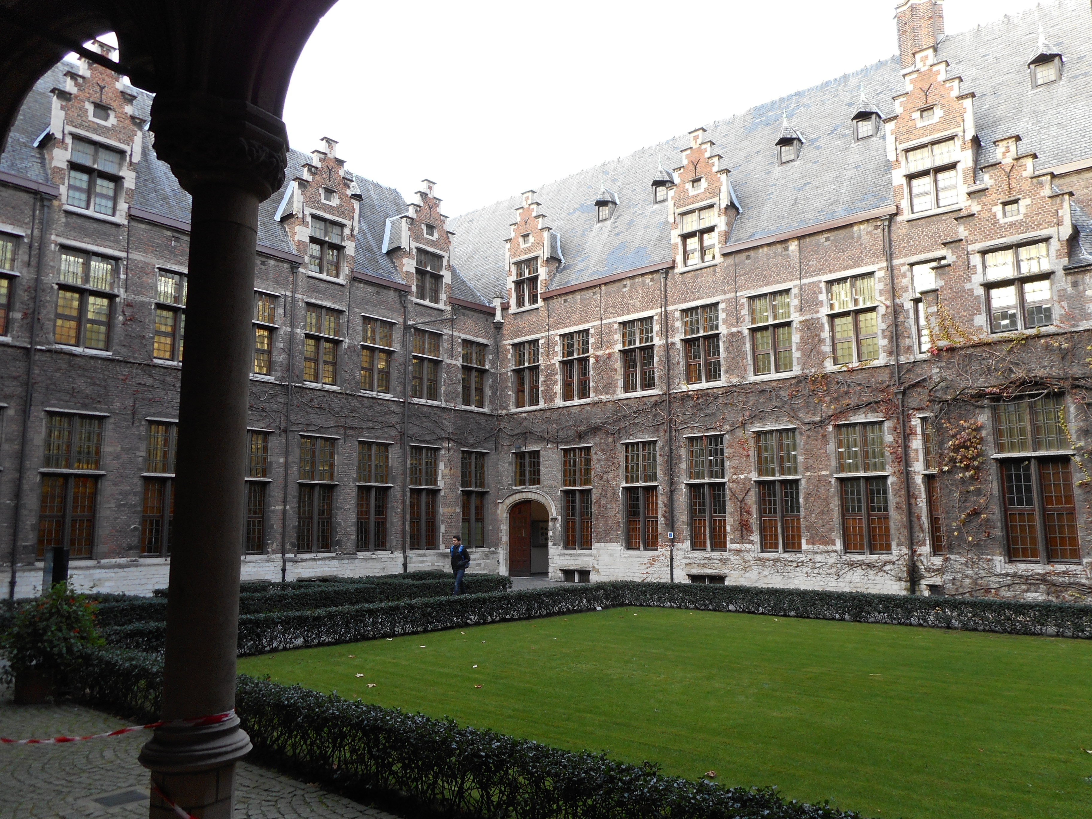
Category: Outdoors

Middelheimpark

Most tourists concentrate on the historical city centre. I’m not saying that this area isn’t worth visiting, on the contrary, but in that way they miss a great number of interesting places, like e.g. the Middelheimpark. This park is situated on the south side of the city. There’s plenty of parking space in the area and lines 21 and 32 have a stop at the nearby Middelheim clinic.

In the sixteenth century well-to-do merchants of Antwerp started to build summer residences in the area around the town. The fields and meadows were quickly transformed into gardens and parks. When the city population exploded at the end of the nineteenth century, the city succeeded in buying a large area south of the city and decided to save it from the building craze that was happening in the rest of the city outskirts. In that way they created a majestic surrounding where people from the city could and can still find a little bit of rest in nature.

Tony Craigg – Envelope

In 1950 mayor Lode Craeybeckx decided to organise an exhibition of present-day sculptures in his town, and it was decided the exhibition would take place in open air, in the park called Middelheim. One of the artists he had invited, Zadkine, came with the idea to organise such an exhibition every two years, 20 editions of this ‘Middelheim Biënnale’ were held in the odd years, to complement the Venetian biannual that was held in the even years. The last one was organised in 1990, not in the least because the success was rapidly declining. After that all energy went into the 1993 project: in that year Antwerp became the Cultural Capital of Europe, and of course the open air museum also took part in the events. Ever since then thematic exhibitions were held on the Middelheim grounds, practically every year. As part of the Rubens Inspires project in 2018, the Middelheim museum organised a successful exhibition under the title Experience Traps.

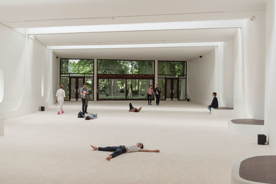
In the mean time the permanent collection of sculptures had grown to over 60 works of art spread over some 30 ha. The sculptures cover the era from Rodin up to the present day.

This park and the museum can be visited for free every day but Monday. Opening times depend on the time of year, so be sure to check the website.

Suikerrui: gate to the underworld

Round 1200 the Suikerrui formed the Southern border of the town, but pretty soon the city started to grow and the Suikerrui only held its function as an inner harbour. If you see a streetname that ends on rui, vliet, vest or brug, it means that there used to be water in the neighbourhood in former times. Unfortunately all this water has disappeared from the city, or maybe it is better to say that it is kept from sight, because under street level the complete canal system is still present.

Ruihuis

A view of the Ruihuis
Source: cdn.verkeersbureaus.info

Through the Ruihuis you can explore this underworld city: together with a guide you stroll from Grote Markt to the Keistraat, which is situated right next to the river, in the neighbourhood of the red light district. In the Ruihuis you get a pair of boots, an overall and a backpack to carry your personal shoes and coat in. At the end of the walk you turn in boots, overall and backpack and you can continue to explore the city in bright daylight.

A walk through the Antwerp underworld is sure to give you a completely new look on town.

Diva

The former police station is being restored. Later this year a completely new museum will open its doors here. A museum devoted to silver and diamonds. The collection is largely based on the collections of the former Sterckshof and Diamond Museums, but it will offer more than a traditional museum. There will be demonstrations and interactive displays that show all aspects of silver and diamond. Undoubtedly Diva will be one more reason to come and visit our town.

Hanzahouse

The building on the corner of Suikerrui and Jordaenskaai was built by a German banker, Mallinckrot and designed by Joseph Hertogs, who drew plans for a great many buildings for members of the German colony in Antwerp. The statues that adorn the façade were made by Jef Lambeaux, who is also responsible for the Brabofountain on Grote Markt.

Van Straelentower: the higher the richer

The Van Straelen Tower
Van Straelen’s Tower (Source: erf-goed.be)

In the neighbourhood of Hof van Liere and Saint-James’ Church (St-Jacob) you can find a very nice example of a ‘pagadder’ tower. The tower belonged to the mansion of mayor Gilbert Van Straelen. He lived in the 16th century. You can find the tower in the Korte St-Annastraat at the end of the Frans Halsplein.

The word pagadder is a bastardization of the Spanish pagador or paymaster. In the local dialect pagadder for some reason has become the name for a small boy. Maybe it is because the Spanish paymasters (soldiers whose responsibility it was to pay the other soldiers’ wages) were much smaller and weaker than their active colleagues.

It is said these young boys had to sit in the tower and look out for ships sailing into the harbour. As soon as they saw a ship, they had to inform their master of the arrival.

That should explain the existence of the towers. It may be clear from this example that this old story is just a tale. From here it is impossible to see the tiniest part of the river.

Italian influence

These city towers arose in the sixteenth century. They are based on Italian examples. It is no wonder that they appeared in this timeframe. Many artists from the North went to Italy to learn about renaissance art. They did not only bring along sketches of ancient sculptures and modern paintings. They also drew the places they had visited.

Van Straelen Tower seen from the inside
Seen from the inside (Source: inventaris.onroerenderfgoed.be)

Very soon the major families and merchants started to outdo their competitors by building city towers that were higher and more impressive than their competitors’. Van Straelen’s must have been one of the best examples. We will never be really sure because at one time there must have been over 40 of these constructions. Only a handful have survived.

But they were functional nonetheless

Smart merchants do not only think of prestige, at least not all of the time. These towers are a nice example hereof. Inside the towers a staircase between the different storeys of the house could be built. That way more space remained available inside the rooms. Most towers are tucked away in a corner and are much smaller than Van Straelen’s.

The building is now used by Emmaus, an organization that takes care of young people who live in difficult circumstances.

Meir: a swamp turned into a shopping center

Meir Shopping Street
Source: Alles over Antwerpen

Today the Meir is the shopping heart of Antwerp, visited by millions of people each year. Around 300.000 people a week visit the Meir, so be sure you’ll never feel alone. Most of the buildings you see there date from the 20th century. Two notable exceptions you will find in the middle part. Both are works of Jan-Pieter van Baurscheidt, the most important architect of the 18th century. He built the Osterriethhouse (currently under restauration) and the so-called Royal Palace, both for the van Susteren family in the middle of the 18th century.

There are many other remarkable buildings a bit further east. For instance the former Tilquin store (nowadays a Massimo Dutti shop) which is a remarkable example of art deco. This is worth a story of its own. So is the ‘Stadsfeestzaal’ (the City Festive Hall) and the buildings Innovation now occupies, that once belonged to Leonard Tietz.

Meir = Moor

Hand sculpture
Source: meir-antwerpen.be

The name Meir is like the word moor in English: a wetland, and indeed the most western part of Meir lay lower than the surrounding places, so water gathered there. Until the 12th century the city walls were situated just west of the Meir. When the city started growing in the 13th century, the Meir was turned into a canal with walking space on both sides.

Important people started to settle around the Meir. Among them the Pijpelinckxfamily, traders in tapestry. A grandson of theirs would turn out to be a genial painter: P.P. Rubens.

Gradually the waterway was covered and the city grew further east. In the 19th century the council decided to demolish the old defensive wall. At that moment they also decided to create a new axis of avenues to greet arriving visitors. The first part of the axis was the Leysstraat, the second part the Meir. Until the late ’80s of the 20th century the Meir was full of traffic. After the underground tramway was built the council turned it into a pedestrian area. A real success, taking into account the 300.000 visitors that walk the Meir every week.

Hof van Liere: a symbol of wealth

Between 1515 and 1520 Arnold van Liere, mayor of the town, had a mansion built on newly developed grounds to the east of the city. People say one of the many guests to stay with mayor van Liere was the young Charles of Habsburg. The same one who later became Emperor Charles V. That is why this mansion is still called Prinsenhof. It also explains how the Prinsstraat got its name. Another visitor to stay with van Liere was the German painter Albrecht Dürer. In his diary he wrote he had never before seen a house so beautiful, so rich. One of the architects for the complex is Domien De Waghemaekere, one of the top architects of the era.

Different functions for Hof van Liere

Hof Van Liere – First Inner Court

After van Liere’s death the city bought the complex and housed the English Nation in it. A corridor linked the complex with the wool store houses in the Venusstraat. After the Spanish Fury of 1576 many English traders decided to leave the city. By 1583 the English House stood empty.

In 1601 Albrecht and Isabella wanted to install the house as their residence. This was refused by the magistrate. They preferred to hand over the complex to the jesuits. They wanted to use it to house their college that had grown too big at Conscienceplein.

In 1713 the jesuit order was abolished. In the Austrian period the buildings were used as a military academy. The French used it to house a military hospital in it. Afterwards the building started to be neglected and got the nature of a ruin.

Re-enter the jesuits

Library in City Campus UA
Source: Vlaamse Erfgoedbibliotheek

In the first half of the 20th century the jesuits took possession of the neglected buildings. They started a series of restaurations and renovations to make the building fit for their Higher Commercial School “Sint-Ignatius”. In the ’60s this highschool was transformed in a university. UFSIA (Universitaire Faculteiten Sint-Ignatius), which later fused with the other Antwerp university center (RUCA, run by the government) to eventually form the University of Antwerp.

Nowadays Hof van Liere houses the City Campus of UA. In recent years a completely new library has successfully been incorporated the historical buildings.

The website of UA: https://www.uantwerpen.be/en/

Conscienceplein: start of a new era (2)

The library

Last Thursday I ended by talking about the building on the west side of the Conscienceplein: the sodalities. After the pope had abolished the jesuits in 1773 the buildings and everything in them were publicly sold. The building the sodalities had occupied in the previous years got different functions. It was a workshop, warehouse, dancing hall, public bar (a brewer’s advertisement can still be noticed) and so on. In 1879 the City Council bought the building to house the town’s library.

map Conscienceplein
Map Conscienceplein (source Googlemaps)

In fact there were two: a library of old, valuable books and manuscripts and a library where people could rent the more current type of books. That is why at the end of the 19th century a statue of Hendrik Conscience was placed in the niche of the sodality. Hendrik Conscience at that time was the most important author in Flemish literature, as popular in Flanders as Victor Hugo was in France.

From about 1622 till the French revolutionaries demolished it, a statue of the Holy Virgin has stood in the same niche.

You can find the entrance to the library now in Korte Nieuwstraat. Guided visits are organised and the 19th century ‘Nottebohmzaal’ certainly is worth a visit. These visits start from the green door in the south-west corner of the square. [http://www.consciencebibliotheek.be/en]

The church

The building opposite the sodalities/library is the old jesuits’ church devoted to Saint Carl-Borromeus. It is generally accepted that Rubens had a hand in the decorations of the façade and of the bell-tower which you can find at the back-side along Sint-Kathelijnevest.

It is clear the church is built in the typical jesuitstyle as laid out by the Roman Il Gesù Church. Giving a detailed description here would lead us too far, so have a little patience.

The square

Young people at the iceblock blockades.
Young people at the iceblock blockades. (Source: Mhka).

In the 1960’s this square was the scene of an artistic uprising, joined by many young people in town to put an end to the reign of the Car. Using huge blocks of ice they blocked off the entrance to the square for cars. Musicians, artists, dancers and pedestrians took over the space. The uprising was a success and not only the square, but also the surrounding streets became the very first pedestrian zone in Antwerp. Of course for weddings and funerals car can still enter the square.

Short video fragment (Dutch commentary).

Conscienceplein: start of a new era (1)

The Conscienceplein, situated in front of the Carolus-Borromeüs church, is an interesting place to visit in more than one way. It is an early example of urbanism, has some very interesting examples of baroque architecture and in the latter part of the previous century it became the very first pedestrians only zone in town.

Early Urbanism

A simulation of Antwerp around 1200
A simulation of Antwerp around 1200 seen from the west

Around 1200 the city was surrounded by a series of canals that started in the south with Suikerrui which ran into Kaasrui, then continued to Wijngaardbrug all the way to Koepoortbrug and eventually ended in Koolkaai which ran into the river.

By the 17th century the city had grown and now was defended by a huge wall that ran in a semicircle around town. The present day ‘boulevard’ (Italiëlei, Frankrijklei, Britselei, Amerikalei) is built on the remains of this defensive wall. That meant that the town no longer needed the old ruien-system for defensive reasons. People had been using them as sewers, so they must have stunk very badly when the weather was hot. Therefore the authorities encouraged owners to cover the canal bordering their property. Sometimes the land was given for free.

In come the Jesuits

When you come from City Hall or the cathedral, you enter Conscienceplein from the west. Take a look at the smaller houses on your left (north side). At one time the whole square was full of houses like these. When the jesuits returned to Antwerp in the early 17th century, about half of the population had fled the town and the Spanish authorities. Most of them had gone to Amsterdam, Haarlem and other Dutch cities and taken their trade with them.

A view of the jesuits' lodgings and the sodalities on Conscienceplein
A view of the jesuits’ lodgings (left) and the sodalities (right)

Anyway, many older houses stood empty and the jesuits decided to create their stronghold on Conscienceplein. Unlike other religious orders jesuits do not live in cloisters or abbeys. They lived together in a house like the one you see on the south side of the square. In this part of the buildings the jesuits also opened a college where they trained young men in the classic languages.

Underneath these buildings on the south side of Conscienceplein, the old ‘rui’ still flew, turning to the north to pass underneath the church and flow into what is now the Minderbroedersrui.

The building on the west side housed two ‘sodalities’. These were congregations of lay men (the single ones on the second floor, the married ones on the first floor) devoted to the service of the Holy Mother.

Rubens was a member of the sodality on the first floor, Van Dyck took part on the second floor. Both made nice paintings and decorations for their sodality, but unfortunately the Austrians took them at the moment the jesuit order was abolished in 1773. We must now travel to Vienna to get a glimpse of these works.

To be continued

A quiet spot in the middle of town: the Antwerp beguinage

Entrance to the beguinage in the Rodestraat

A beguine is a woman who lives together with fellow sisters inside a beguinage, a little secluded from the world. Like a nun she has vowed to obey the convent’s head-mistress (grootjoffer), to live a life of poverty and chastity . Unlike a nun she can always leave the community she is living in.

History

The first beguines appeared around the era of the crusades. The many wars in Europe and the crusades themselves had resulted in a surplus of women. For many of them it had become impossible to find a suitable mate. Moreover very often they could not raise the dowry to enter a classical convent. So they started forming groups of women who lived together and performed chores to earn their living.

Among these chores were laundry work, nursing, teaching, lacework and the like. At first the Church authorities regarded them with some mistrust. They feared it might result in a new form of heresy, but gradually the Church accepted these half-nuns. Usually a monk, mainly franciscan or dominican, looked after them and guided them in their religious life.

A view of a street inside the beguinage

In the twentieth century the number of beguines dropped drastically. Nowadays there are no beguines anymore. At least not in our region. In some German towns like Hamburg e.g. a new beguinage arose, although the religious aspect is not always as important as it used to. These present day beguines do not live in a hierarchically ordered society either.

Spread

Almost every town in the Netherlands used to have a beguinage. Some cities had more than one. In its heydays a beguinage could count 150 to 160 beguines which was a bit difficult to manage. So very often they founded a new one.

In 1998 13 Flemish beguinages were placed on the UNESCO World Heritage List. Unfortunately the Antwerp one wasn’t. The Antwerp beguinage used to border the city walls. In World War II the area suffered tremendously from bombings and in the 1960’s blocks of flats were built. The backsides of these blocks now befoul the view from the beguinage.

Still: the beguinage with its interior garden is an oasis in the otherwise busy environment of the students’ quarter. The center of the Antwerp University and the Ossenmarkt with its many bars, lie just around the corner. If you go there, respect the quiet of the place, please.

More information on Flemish beguinages can be found here.

Parks in and around town (1)

A view from the bridge in City Park
Source: Joods Actueel

Like all cities worldwide, Antwerp too has its share of parks. We have a few nice parks in the city itself. Many more are situated in the bordering districts like Merksem, Deurne, Borgerhout, Wilrijk. Up till the end of the 20th century these districts used to be separate villages, but then they fused into Greater Antwerp and became districts.

City Park

One of the most interesting parks in the city itself is Stadspark (City Park) in a triangle bounded by Rubenslei, Quinten Matsijslei and Van Eycklei: three great painters from three different eras. Rubens is the giant of  baroque painting. Quinten Matsijs is a renaissance painter. He founded the Antwerp School and Jan and his brother Hubert Van Eyck are Flemish painters of the gothic period. People all over the world know them for the Ghent Altarpiece.

An overview of the botanical gardens
source: antwerpen.be

The area of the Stadspark also borders on the diamondquarter and the jewish quarters of Antwerp. Up till the end of the 19th century the park was part of the town’s defensive wall. We still call it the ‘Spaanse Vesten’. Water for the moat came via the Herentals Canal (now the Plantin-Moretus Avenue). Part of it was used for the moats. Another part was led into the city to furnish the brewers in the Kammenstraat with fresh water.

Typical for the park is the great many statues that decorate it.

Botanical Garden

Not so far from the Stadspark is the Botanical Garden. It belonged to the old Elisabeth Hospital and borders the Leopoldstraat. The present lay-out with balustrades and glass houses goes back to the early 19th century.

Visitors in the Antwerp Zoo
Source: gardenstyle.be

Zoo

A third park, probably the most interesting one, is our Zoo. These zoological gardens are among the eldest in Europe. They house a great many different kinds of animals from all over the world. They also harbour some of the eldest trees in the city. The whole complex has been protected as a monument, trees included. At some other time I’ll certainly be back to tell you more about this shiny diamond in our city’s crown.

At a later occasion I’ll also tell you more about the parks in the different districts.

Dageraadplaats – off the beaten track

A very lively neighbourhood with a lot of bars and restaurants can be found at Dageraadplaats, which is the heart of Zurenborg. It may be little known by tourists, but is frequented by locals. This is an area where people of different origins live together, and it shows in the types of restaurants you can find at and around this little square.

The square can easily be reached by public transport (Line 11 has a stop at the square). Moreover, just a few steps away is Cogels-Osylei, a city quarter that was developed in the era of art nouveau and Jugendstil. Fortunately practically all of the houses in this street, and the sidestreets leading up to it, have been protected as monuments. It surely is a unique sight.

Soon I will tell you more about this fascinating area.

To make your visit to this website as smooth as possible we use cookies. The cookies are used for statistical reasons and do not store any personal data. If you do not wish to use cookies. You can indicate this by clicking on the No button.